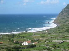
Sorry if I seem a bit obsessed with the weather on this blog but when you've got the Atlantic Ocean at the bottom of your garden, it becomes more of a preoccupation. Also, people tend to assume the Azores are "tropical islands" - i.e. "sun kissed palm trees, white beaches and blue seas". (Well certainly blue seas, one or two palm trees but
black beaches - volcanic, you see).
I've digressed already (but isn't that the point of a blog?)
Anyway, I wanted to share this satellite image from earlier this week which encapsulates a "weather moment" very clearly:-

Flores is the little dot in the (small) red circle to the left of the pic. Note the line of cloud (white) over us. That was a cold front. It's moving south east. When the satellite snapped this pic at about noon, it was raining very hard. But a couple of hours later, in the afternoon, it cleared up and was bright and sunny as the front passed over south east: we emerged into the clear - but cold as it was coming from the north west - air behind the front as the satellite pic clearly shows.
Weather in action, as it were, brought to you by the Finnish Meteorological Institute's website available (free) at this link:
http://www.fmi.fi/weather/rain_5.html
 Compare with the image below.


 Sorry the image is a bit fuzzy but taking a picture of a plastic bag with a flash produces disappointing results.


